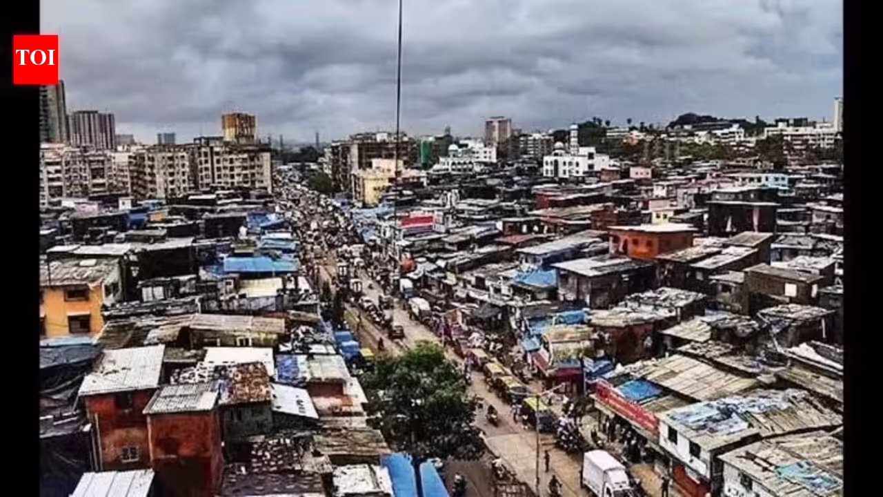

Mumbai: Dharavi has a digital twin. The heavily congested slum will, over the next 10 years, give way to multi-storey structures. Rehabilitation buildings will sit next to luxury towers and corporate offices. The digital twin will preserve the data of the existing township, to be pulled out and studied when required.“The digital twin is an exact replica of present day Dharavi. Except for a few areas, all of Dharavi has been extensively mapped. It’s like a hologram which, when pulled up, opens up to reveal every detail of the structure and residents of that unit,” said an official, requesting anonymity.Adani Realty group, the lead developer for the Dharavi Redevelopment Project (DRP), has used technology to capture and maintain records for every household in Dharavi.A spokesperson for the Navbharat Mega Developers Pvt Ltd (NMDPL), the special-purpose vehicle for executing the DRP, said digital mapping is not for posterity or an archival record, rather it is being used to establish claims of residents to free or rental housing by capturing documents, including litigations.The digital twin is currently being used by DRP/SRA to verify documents before issuing the final annexure 2 list that finalises eligibility of slum dwellers, said an official.Initially drones were used to survey the entire 621 acres. This helped identify 1.25 lakh units in Dharavi. This was followed by a ground survey of lanes in Dharavi using the LiDAR technology. This helped capture details of a lane — number of structures, number of floors, whether commercial or residential structures. On average there are 150 huts in every lane.A digital map of Dharavi was then prepared and on it a 3-D model of every tenement along with its details such as size, ownership, documents produced by the resident were captured digitally. All this data has been fed into an app.“Dharavi is divided into five sectors and there is the railway land at Matunga identified as sector 6, which adjoins sector one and sector 5. Every unit in Dharavi has been given a unique identity number. So, when the actual door -to-door survey was started, surveyors were provided with the app on a tab to enter details of residents along with documentary evidence against each unit,” said an official.Surveyors have collected hard copies of documents that have been archived with a data archival company called Iron Mountain Co Ltd at Nalasopara. The survey of 95,000 units has been completed both physically and digitally. Documents have been verified for 85,000 units. There are still areas such as Kumbharwada, Shankar Kawade Chawl, Gopal Vilas Palwadi, NDG Compounds, Lahuji Bhimji Chawl and Nawab Nagar where the survey is yet to be completed.